
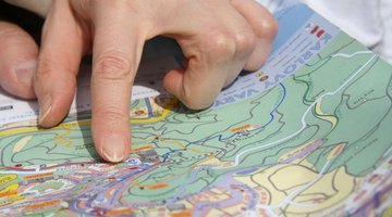

Cartographers use map legends to detail what various symbols and colors represent on a map. The legend essentially acts a key to the map. To adequately understand a map, readers must use the map legend to determine elements such as scale, topography, climate, roads and boundaries.
Visibility, Legibility and Symbols
When creating a map, include a clear and legible legend that is positioned in a visible space. Typically, map legends are placed in one of the four corners of the map so that they can be quickly referenced. Draw a box surrounding the legend to clearly separate it from the rest of the map. Identify all of the symbols used throughout your map. If you have a created a map of the United States and its capitals, use your legend to signify that a star represents the capital of each state. Use circles to represent cities in the United States and small triangles to represent mountains. If you are color coding different climate zones, explain how each color coordinates to the climate in your legend.
Drawing a Scale
Many maps are drawn to scale, so provide a map scale in your legend to show the ratio of the distance on your map to the actual distance. If 1 inch on your map represents 100 miles, represent that ratio. A line drawn in your map legend with the ratio measured out and identified is a suitable scale. Doing so will enable readers to more effectively interpret and follow your map.
Related Articles


References
Writer Bio
Kelly Chester is an educator and writer who has worked in both public and private schools for almost a decade. Her areas of expertise include literature, writing, history and art for adolescents. In addition to writing reports for NYSAIS, she has also written a biography on artist Frank Covino, which was published in the anthology “Teaching Lives.”